
40 Years After The Flood: A Question Now of When, Not If
The city of Roanoke is seeking stories and pictures from the epic flood while preparations continue in wait of the next.

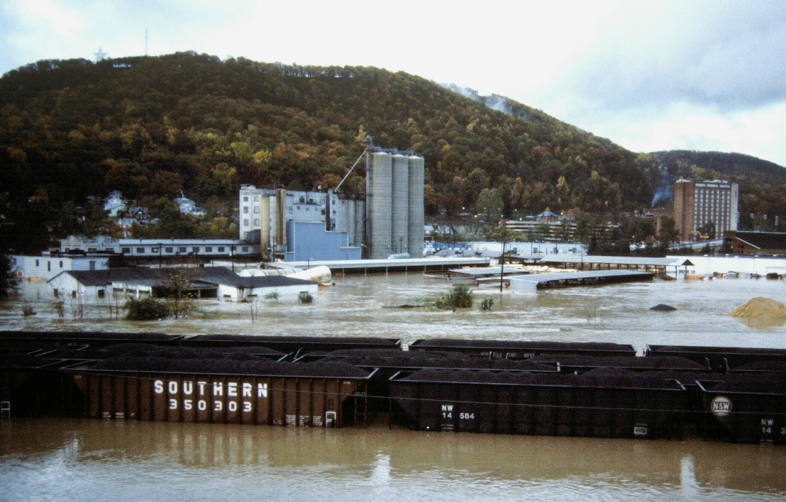
On Election Day in 1985, water was the frontrunner.
Close to seven inches of rain fell Nov. 4, on top of another previous four inches. The Roanoke River crested at 23.3 feet. A substantial portion of the city was submerged. Ten people died. The cost to recover was over $500 million in today's dollars, according to city data.
The crest and the rain amount over a 24-hour period still stand as records.
As the flood’s 40th anniversary approaches, the city created a webpage, Roanoke Remembers, and is asking the community to submit stories and photos. It’s a way to preserve that important history and to also learn more to be better prepared, according to the site.
In the four decades that have passed, much has been done to improve the city’s flood preparation: A $72 million project on the Roanoke River was completed, which included bench cuts to better contain floodwater; $6.3 million was spent moving 119 structures out of floodplain areas; and the city has created a budget to continue to identify and complete projects to mitigate flooding.
The city also created a climate change plan. And that’s part of continuing mitigation efforts.
That plan acknowledges the expected impacts of a warming planet, including increasing chances of heavier rainfall and dangerous storms.
The city’s Flood Resilience Plan states: “In general, climate forecasts suggest that average temperatures in Virginia will increase by 4°F by the year 2100 and Roanoke’s climate will feel more like the present-day climate in Tuscaloosa, Alabama.”
That plan includes expectations that the chances of 10-year and 100-year storms will increase by as much as 25 percent in the coming decades. The Flood of ‘85 is considered a 1-in-175-year event.
In an email to The Roanoke Rambler, Michael Mann, a nationally-known climate scientist, wrote that greater extremes at the ends of the hydrological spectrum can be expected: worse summer droughts and also more intense rainfall because of a changing atmosphere.
“It’s really a double whammy,” he wrote.
Mann’s research identified persistent large-scale systems known as “atmospheric resonance” that trigger extreme weather.
Climate model projections aren’t fully capturing the potential for increasingly persistent weather extremes as the planet warms through fossil fuel burning and carbon pollution, wrote Mann, a professor at the University of Pennsylvania.
Recent catastrophic storms serve as a harbinger. The Roanoke Valley barely missed the brunt of Hurricane Helene last September – a storm that destroyed parts of Asheville, N.C., and other areas, including sections of the New River Valley, which continue to recover. And national attention turned to the Hill Country of Texas on July 4, where over 100 lives were lost along the Guadalupe River, where 20 inches of rain fell in a day.
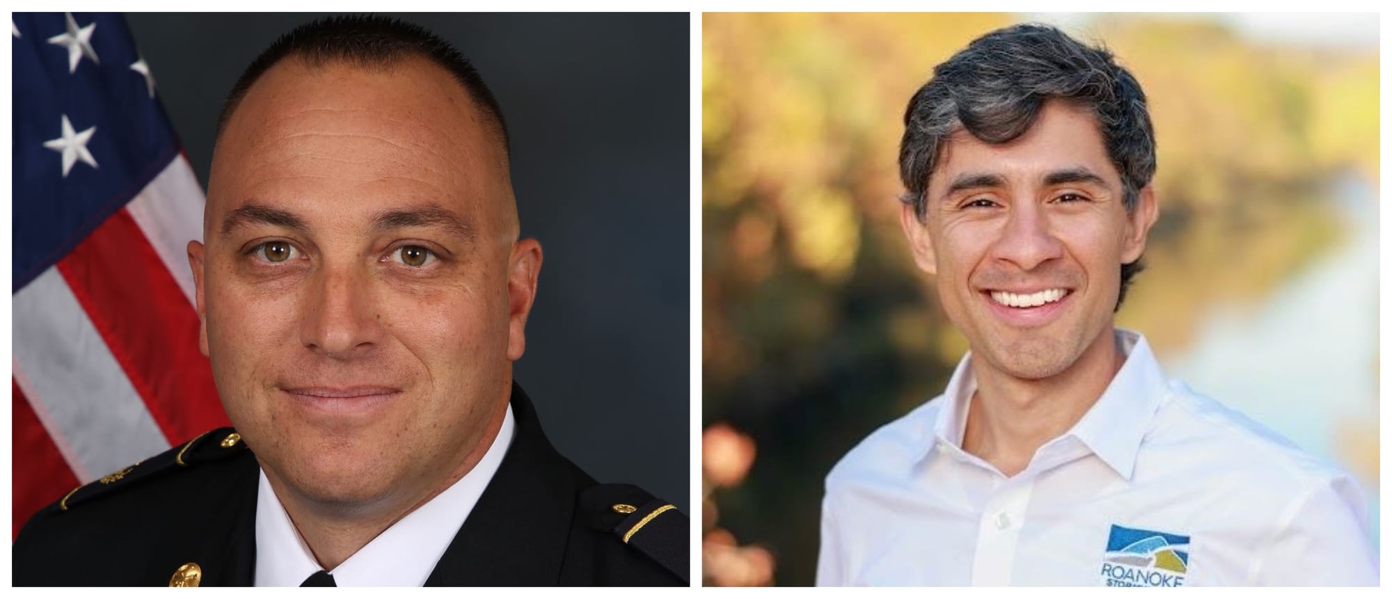
Members of the city of Roanoke’s stormwater team sat down for an interview earlier this month to discuss where mitigation efforts stand and what could happen with today’s weather. They included Stormwater Utility Manager Ian Shaw, Civil Engineer Marcus Aguilar, Water Quality Administrator Mckenzie Brocker and Trevor Shannon, battalion chief of emergency management for the city’s Fire-EMS Department.

Brocker said the big name storms that attract attention are fortunate – and unfortunate.
“They remind people it could be a possibility here,” she said. “But that kind of wanes over time.”
Alerts and other technological advances – combined with coordination among different agencies – have improved response, they said. But nothing is perfect, they added.
Human nature is one factor.
People trying to drive through floodwaters remains the top reason for rescues, said Shannon, who leads the city’s swiftwater emergency team.
“I get really passionate about that,” he said, “because swiftwater rescue is the most dangerous thing we can do, and greater than 90 percent of the time we put people in the water because someone drove around a barrier and got stuck.”
He recalled a storm about 12 years ago, during which the team had to evacuate a daycare on Peters Creek Road Northwest – but it was sunny in Southeast.
“So even in the city, it’s challenging to really know where this is going to happen,” he said.
And there’s Roanoke’s history and status as the largest urban area in western Virginia – which includes commercial and residential growth that has complicated flood issues with an increase in impervious surface since 1985.
“We’re an older city with older infrastructure,” Shaw said.
Aguilar said if you compare today to, say, 1950, he does believe there is an ever-increasing chance of flood risk.
That’s because it is a warmer planet and the climate carries more moisture. And, since 1950 there is more development — and that has happened in urban areas such as Roanoke.
If rain comes similar to that with the ‘85 flood or Helene, “it’s going to flood,” Aguilar said. “The river is going to come up, it’s going to go over its banks, it’s going to be at flood stage. That’s going to be here in Roanoke. It’s going to be anywhere in the U.S. or probably in the world.”
The question is, will that impact humans and is there an ability to manage the risk before the flooding happens as well as moving people out of the way during an event, he said.
Planning and collaboration continue to evolve, all four interviewees said.
The use of swiftwater teams is more proactive, Shannon said. The state now coordinates with all those teams to move them to areas where forecasted flooding is expected before it occurs.
The city, meanwhile, has more money and is better at identifying projects that will get the most benefit versus cost, Shaw and Aguilar said. In recent years, an instituted stormwater fee generated funding to pay for improvements. The city now has an annual budget of about $7 million for that purpose, and the stormwater department is studying computer models and using other technology to decide what priorities should be, Shaw said.
An example is a $2.8 million project ongoing at First Street and Salem Avenue in downtown. It was the result of research that included probes that measured water flow under the streets downtown, Aguilar said. From that, data showed that capacity could be increased at a pinch point at First and Salem that will improve moving floodwater out of downtown, he said.
The city stormwater team, too, said its relationship with the National Weather Service remains vital.
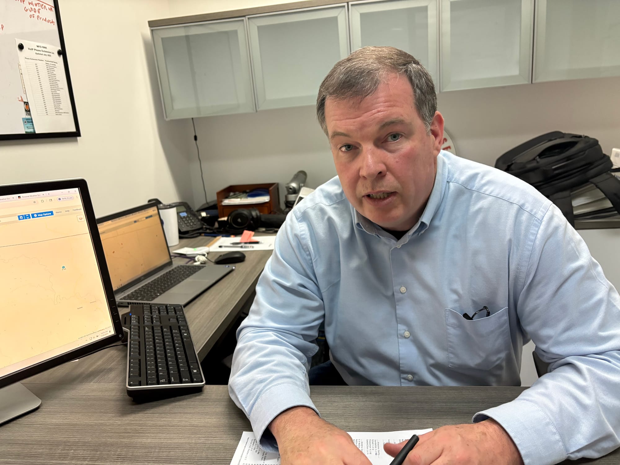
Nick Fillo is the senior service hydrologist at the NWS office in Blacksburg.
When he started as meteorologist decades ago, he said, there were four weather models to survey – and they were independent of one another. Now there are up to 60 at any moment which are using algorithms from all the data, driven by ever increasing computer power now including artificial intelligence, he said.
During an interview this month, Fillo pulled data from a severe thunderstorm in the Midwest from the night before. He could track the amount of rain falling at a particular location in two-minute intervals.
From that standpoint, the NWS can get information to localities in real time during an event, to pinpoint and warn people in relatively small areas where rain may be falling at dangerous levels.
When asked his thoughts on the increasing chances of severe storms, Fillo said it can still be hard to predict, for instance, when four inches of rain is going to quickly turn into eight to 10 at any one given time based on circumstances with an individual storm.
The difference today is the NWS’ ability to gather and track information over a more specific area. That includes its computer models, weather balloon data, and a system of volunteer observers who use current technology to send information to the weather service. And the NWS staff is constantly talking about what happened with other storms, such as Helene, to try to learn from them, he said.
Fillo and the city’s stormwater team also said the most important task citizens can complete: Sign up for – and heed – alerts.
“Looking back at these past storms, early notification, early warning is huge and it’s critical, but we don’t have a tremendous success rate on everybody signing up for our mass notification system,” said Shannon, with the Fire-EMS Department.